The name "Sargenta Ruc"
The earliest name we know for this stretch of coast comes from the baptismal records of Mission San Carlos de Borroméo de Carmelo.
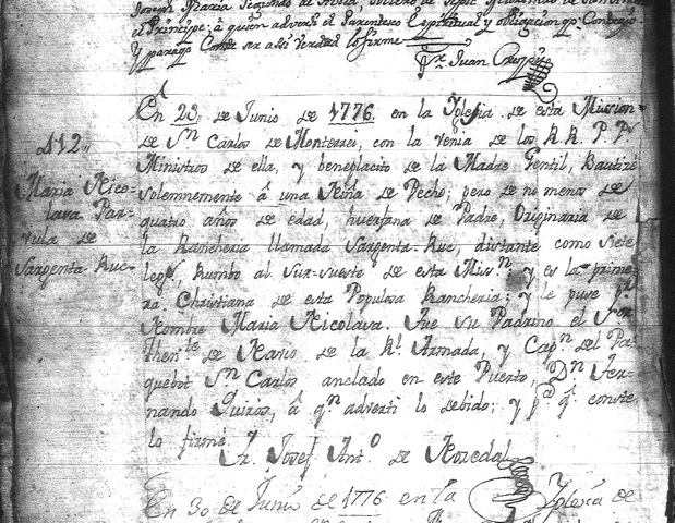
On June 23, 1776 in the mission church at Carmel, a girl about four, who was still nursing, was baptized. She came "from the rancheria called Sargenta Ruc about seven leagues from this mission toward the south-southeast. She is the first Christian from this populous rancheria" — and she was given the Spanish name Maria Nicolasa.
The Spaniards used the term "rancheria" in two senses. Sometimes they used it to refer to the population of a general area — what we might call a "district." At other times "rancheria" refers to a specific village-site.
Seven weeks later, on August 15, Maria Nicolasa's mother was also baptized. The delay between the two baptisms can be explained by the fact that as an adult the mother would need to have been given instruction in the faith before being baptized.
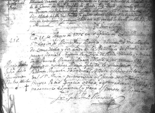
The mother, about twenty-two, is described as coming "from the rancheria Pitchi in the district ("el parage") called Sargenta Ruc." Since the mother and daughter were almost surely from the same place, we can put the two baptismal records together to assume that Pitchi was a village about seven leagues downcoast from the mission in the district of Sargenta Ruc.
But since the people of Sargenta Ruc were hunter-gatherers, in this case "village" doesn't refer to a permanent, year-long settlement, but rather to a central location where all or most of the people in the area would gather once or twice a year.
From the Carmel mission records, there seem to have been two main villages in Sargenta-Ruc — Pitchi (or Pis as the name is sometimes rendered), six or seven leagues south of the mission, and Jojopan (or Ojaba), eleven leagues south. Pitchi seems to have been near Notley's Landing at the mouth of Palo Colorado Canyon, and Jojopan at the mouth of the Big Sur River.
Since a league is 2.6 miles, you might think these distances don't quite measure out exactly to Palo Colorado Canyon and the Big Sur River, but if so, you might have highway odometer measurements in mind rather than the rough, winding in-and-out of canyons traveling that the Spanish would've known.
Besides, then as now, topographically these are the two natural locations where greater habitation density would occur.
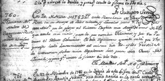
In 1782 Fray Noriega, who signed his mission record entries "Fray Mathias Antonio de Santa Cathalina," traveled through Sargenta Ruc, and on November 20 he baptized a gravely ill woman "in the rancheria of Sargenta Ruc in a creek ("arroyo") of redwoods ("palos colorados") and bays ("laureles") about seven leagues along the coast to the southeast."
The woman, about forty, died later the same day. She had been given the Spanish name Feliciana.
In 1784 Fray Noriega returned to Sargenta Ruc, and this time, on Christmas Eve, he baptized another woman in danger of death, a young woman of eighteen who was one of the three wives of the headman ("Capitan") of Sargenta Ruc. She was baptized "about six leagues along the coast to the southeast in a small cañada ("cañadita") of redwoods ("palo colorado").
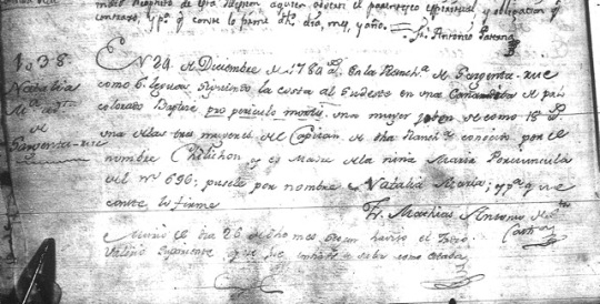
And now, in this baptismal entry 1038, we also read a native name — that the woman's husband, the unbaptized headman of Sargenta Ruc, is known as Chílichon.
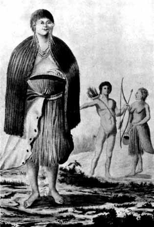 Drawing of natives of Monterey by José Cardero of the Malaspina expedition in 1791
The point isn't to gather obscure data from Spanish mission records. The point is to re-learn what we can about the earliest names of this coast, and more importantly, to realize and respect the actuality of the first people here.
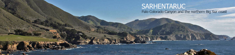
There are surprisingly vivid images that can still be gathered, and periodically this journal will dip into places like mission records to try to find them. But for now, we can remind ourselves of a couple of likely assumptions. First, that at the time of the Europeans' arrival in 1769, there was a district called Sarhentaruc that stretched along the coast from some undetermined point north of Palo Colorado Canyon to an undetermined point somewhere south of the mouth of the Big Sur River. Secondly, that the two most prominent settlement areas in Sarhentaruc were Pitchi (or "Pis"), most likely centered somewhere around Notley's Landing, and then Jojopan (or "Ojaba"), centered around the mouth of the Big Sur River.
That leaves many questions to pursue. Two immediate ones jump out. What language, or languages, did the people of Sarhentaruc speak? And how did they organize themselves, socially and politically?
_____________________________
Notes
This post relies on Randall Milliken's "Ethnogeography and Ethnohistory of the Big Sur District, California State Park System during the 1770-1810 Time Period," 1990. It also relies on research through the microfilm of Carmel mission records at the LDS Family History Center in Seaside.
 Carmel mission records
Reader Comments